Load gnss_lib_py into the Python workspace
[1]:
import gnss_lib_py as glp
TU Chemnitz SmartLoc
This tutorial shows how to load data from TU Chemnitz’s smartLoc GNSS Dataset.
[2]:
import gnss_lib_py as glp
[3]:
# download cropped SmartLoc data file
glp.make_dir("../data")
!wget https://raw.githubusercontent.com/Stanford-NavLab/gnss_lib_py/main/data/unit_test/smartloc/tu_chemnitz_berlin_1_raw.csv --quiet -nc -O "../data/smartloc.csv"

# load smartLoc data into NavData object
smartloc_data = glp.SmartLocRaw("../data/smartloc.csv")
[4]:
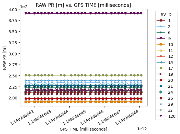
# plot the pseudorange over time of each individual satellite
# SBAS 120 is the outlier with its larger orbit
fig = glp.plot_metric(smartloc_data, "gps_millis","raw_pr_m", groupby="sv_id")

[5]:
# show the ground truth smartLoc data on a map
fig = glp.plot_map(smartloc_data)
fig.show()